The Colorado River flows 1,450 miles from the Rocky Mountains to Mexico, forming the border between California and Arizona along the way. This mighty river supplies water to 40 million people in the West and is a major source of drinking water for Southern California. Most of the water in the Colorado River comes from precipitation in the mountains but, despite the importance of this upper basin, researchers don’t yet have a full picture of high elevation rain and snow in the western Rockies.
“Knowing how much water is in the Colorado River Basin is important for water supply planning,” says Michael Anderson, State Climatologist at the California Department of Water Resources.
California is one of seven states that receives Colorado River water, and flows are declining as warming shrinks snowpacks in the basin. These changes also impact water supplies in the Sacramento–San Joaquin Delta, points out the Public Policy Institute of California in a 2018 report called California’s Water: The Colorado River. Because Southern California relies on water from both the Colorado River and the Delta, shortages in the former increase pressure on the latter.
A new project will round out the picture of high elevation precipitation in the Rockies, collecting atmospheric data to complement the surface and subsurface data currently collected in the region.
“We want to understand and predict the water coming out of the East River Watershed, which is typical of the upper Colorado River,” says project lead Daniel Feldman, an atmospheric scientist at the U.S. Department of Energy’s Lawrence Berkeley National Laboratory. “It’s quite challenging — we need to expand into studies of the atmosphere,” he adds, explaining that what happens in the air, from precipitation to sunlight to wind, affects water on the ground.

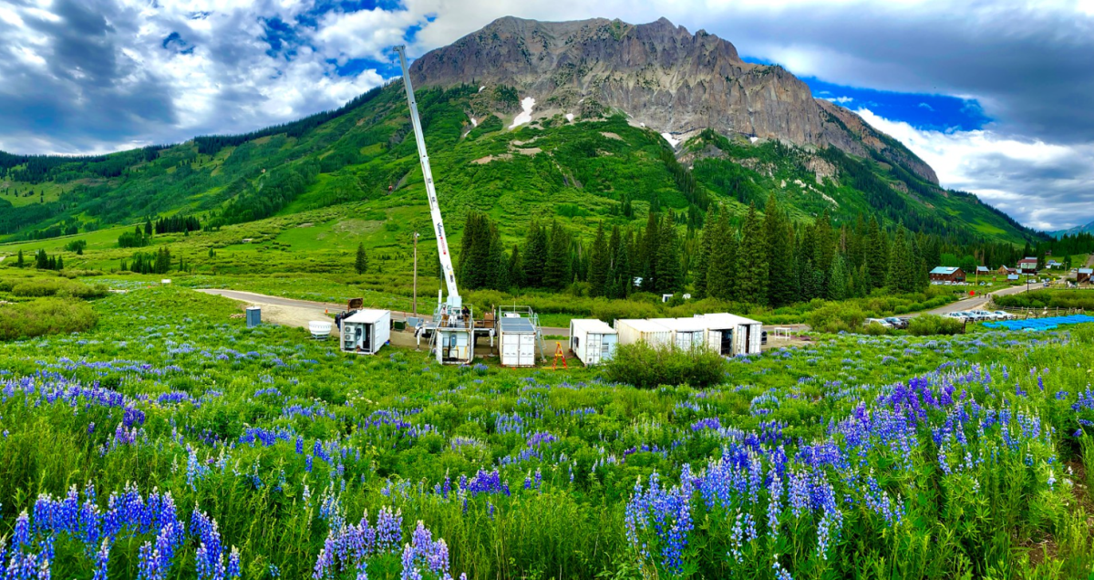
The project Feldman leads, called the Surface Atmosphere Integrated Field Laboratory (SAIL), entails more than four dozen instruments including a precipitation radar and weather balloons at an elevation of about 10,000 feet above sea level near the town of Gothic, Colorado. Collectively, these instruments comprise a mobile atmospheric observatory, and the Department of Energy (DOE) has deployed them all over the world. “They’ve gone to the ends of the Earth and in between,” Feldman says. Other deployment sites have included the Ross Ice Shelf in Antarctica, the Amazon jungle in Brazil, and an icebreaker in the Arctic Ocean.
Feldman and his team learned that DOE had greenlighted their project in March 2020, barely a week before Covid restrictions were imposed. Even so SAIL launched two weeks earlier than planned, in September 2021. The project will run nearly two years and all the data generated will be open access.
“We’re looking at how precipitation varies and why,” Feldman says, citing the extreme variability of the Rocky Mountain snowpack. “There can be a two-fold difference in snow over just 10 miles at the same elevation — it’s pretty dramatic.”
The researchers are tracking a suite of atmospheric processes including rain and snow, aerosols like dust and wildfire smoke, solar and thermal energy, and wind-driven snow redistribution and sublimation in a 115-square mile watershed in the Rocky Mountains. The team uses precipitation radar to measure how much water falls from the sky and into the watershed. “It’s really powerful, especially compared to a weather station,” Feldman says.
Aerosols are tiny particles that can seed raindrops and snowflakes, and can also spur rapid snowmelt. “Spring winds blow dust from lower elevations and deposit it on the snowpack,” Feldman explains. “That makes the snow darker so it absorbs more heat from sunlight.”

The team assesses aerosols in a specially-outfitted trailer. “Instruments suck in air and look at how the light scatters, and how humidity affects raindrop and snowflake formation,” Feldman says.
Atmospheric energy is captured by radiometers, which measure the sunlight coming down as well as heat rising from warm rocks. Wind is measured with instruments including weather balloons that carry tiny sensors to heights of 15 miles as well as a Doppler lidar, which uses a laser to determine which way the air is moving over a six-mile range.
The project will yield a wealth of data, and one of the overarching goals is to determine the minimum data needed to measure water in the Colorado River’s upper basin. Then, rather than deploying an entire atmospheric observatory in other parts of the basin, “we can say you just need this particular set of instruments,” Feldman says.
Vast at about 108,000 square miles, the upper basin already has a network of several hundred surface stations that measure air temperature, accumulated precipitation, snow-water equivalent, and snow-depth. Feldman envisions adding selected atmospheric instruments to a subset of these stations as well as adjusting the network to accommodate climate change. “Other locations may be more ideal as we move into a new future and snowlines creep up,” he notes.


