Sea Grant is a federal state partnership between NOAA and 34 university based programs in every coastal and Great Lakes states, including Puerto Rico and Guam. For over 50 years, Sea Grant has supported coastal communities through research, education, and extension programming. This seminar is part of the selection process for a California Sea Grant Extension Specialist who will be hired jointly with the Delta Stewardship Council. Sea Grant Extension Specialists are housed throughout the state and work with coastal communities to identify and collaboratively address pressing issues associated with the use and protection of California coastal and marine environments. This position with the Delta Stewardship Council will provide leadership in advancing collaborative partnerships and initiatives in catalzying and implementing social science research to inform management of the Sacramento-San Joaquin Delta.
The candidate and presenter for this seminar was Alejo Kraus-Polk. He received his Bachelor of Science in International Agricultural and World Development from Cornell Univeristy with an emphasis in Rural Sociology in 2012. He is now a PhD candidate and graduate student researcher in the Geography Graduate group at UC Davis. During his time at UC Davis, he has participated in various collaborative research and planning efforts that seek to balance ecosystem restoration, flood control, water supply objectives, and human activities in the Bay Delta region. Prior to entering graduate school, Alejo participated in an internship with the Delta Stewardship Council looking at reconciling existing land uses and ecosystem objectives within designated priority habitat restoration areas. This seminar today is titled, Franks Tract Futures: Using map based public surveys to inform a participatory multi-benefit design project.
Mr. Kraus-Polk began by first acknowledging his colleagues, mentors, and funders for the project. He then gave a quote from Delta Watermaster Michael George that appeared in the December 2019 issue of Estuary News:
“We have to decide what to let go of in the Delta, as levees fail, Delta smelt are lost to warming water, and snowpack shifts make it hard to maintain freshwater flows. Lives, fortunes, and sacred honor are all at risk in the Delta due to climate change. Our permitting structure is like a hall with a thousand doors, our State Water Project was never finished, is being called on to do more and is showing its age; thus, we can’t physically do what we want and need to do. No matter what we decide to do, there’s entrenched well-funded opposition to it. But our most intractable problem is the lack of trust; we no longer share a cohesive sense of community purpose, which makes every problem we face more daunting.”
“This is ultimately a presentation about the challenges of building and maintaining trust,” said Mr. Kraus-Polk. “While I will be discussing methodology, data, and technical details, the takeaway message that I seek to convey is that trust is critical to an effective – or better yet affective Delta social science. What I’m presenting on is part of a larger research project on the human uses of restored and naturalized landscapes, and the human dimensions of adaptive management in the Delta, which I’ve been working on for the last 5 years.”
“I am grateful for the education that has made me into a critical environmental geographer that is concerned with the relationship between power, people, and place,” he continued. “As a designer and landscape architect, I also greatly enjoy participating in collaborative processes that are seeking to reshape landscapes in the Delta, and in so doing, reshape relationships with the aim of promoting social justice and equity, as well as healthy relationships with plants and animal communities.”
BACKGROUND ON FRANKS TRACT

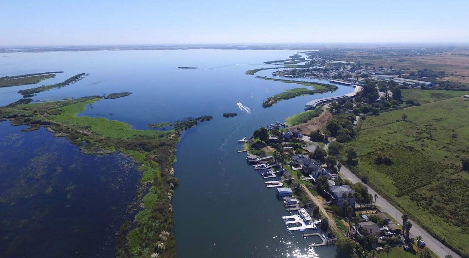
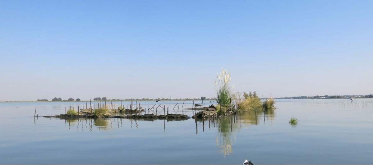
Franks Tract is a nearly 3000-acre flooded island located located southeast of Brannan Island between False River and Bethel Island in the central western Delta. The tract has been flooded since an unrepaired levee breach in 1937 and is only accessible by boat. Very few land forms remain exposed, with the exception of remnant levees. Franks Tract is currently owned by the California State Parks and managed as state recreation area. Management is minimal and almost entirely focused on hunting and fishing opportunities.
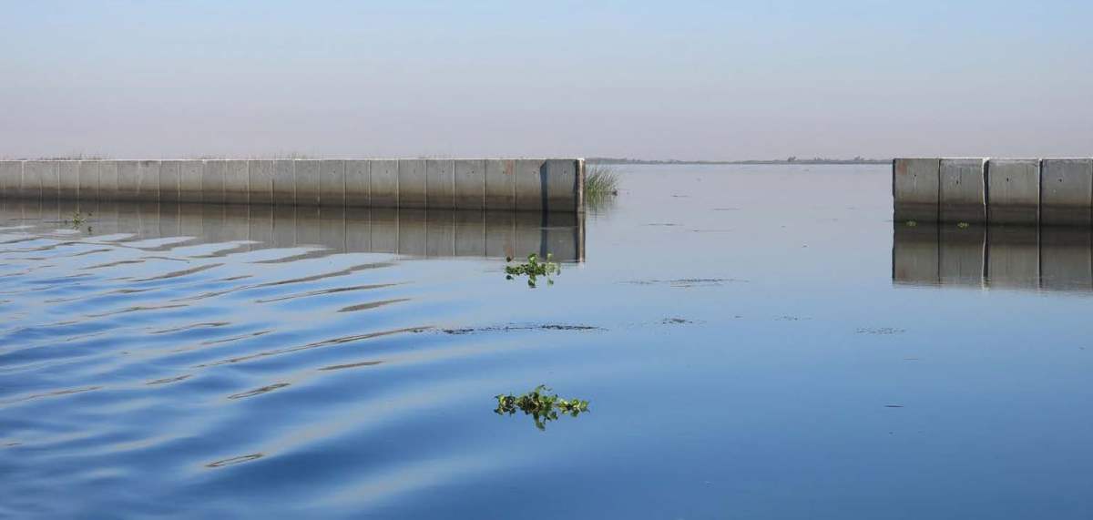
Mr. Kraus-Polk noted that the tract sits at the nexus of nearly every single challenge facing the Delta. The tract is a major source of salinity intrusion into the Central Delta, which during drought years, threatens the water supply reliability of Delta exports. To reduce tidal salinity intrusion, in 2015, the state had to install and uninstall a 15,000 ton rock barrier in West False River right to the west of the tract to a total cost to taxpayers of $37 million.
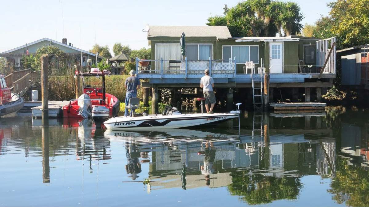
Franks Tract is surrounded by heavily subsided islands, most of which are farmed, but also include Bethel Island, a community of over 2000 residents. The tract supports a diverse recreational economy in Bethel Island and the surrounding communities, which includes bass tournaments, restaurants, bars, boat launches, storage facilities, and hunting. It is also home to a variety of introduced species, some with significant cultural values such as large-mouth bass who flourish there; however, it has become an increasingly inhospitable place for native fish species, including chinook salmon and Delta smelt.
Franks Tract has been described by a stakeholder as ‘the highway interchange of the Delta’ as it provides a short cut for boaters going between the Bay Area and Central and South Delta. Franks tract is adjacent to the urbanizing edge of eastern Contra Costa County, which is increasingly becoming a destination for those displaced by gentrification in other parts of the Bay Area.
PLANNING PROCESSES
Franks Tract was purchased by the the California Department of Parks and Recreation and became a state recreational area in 1957. At the time, it was anticipated that the tract would become the center for California’s water based activities, and in many ways that is the case, said Mr. Kraus-Polk. However, the tract has been beset by problems and for this reason, a number of planning efforts have sought to address these problems, which includes the Department of Parks and Recreation planning efforts to support more public access and address the land based issue and the Department of Water Resources plans to address the issue of salinity intrusion, including one for operable gates.
 The Frank Tract Futures process is building off of the previous Franks Tract Feasibility Study which was prepared by the Department of Fish and Wildlife as an element of the Delta smelt resiliency strategy and conducted in 2017-18 to inform feasible and locally accepted restoration design. Preliminary modeling indicated that the original plan met water quality and ecological objectives; however it didn’t meet other objectives developed during the feasibility study such as those related to navigability, recreations, and sustaining the local economy. So that initial design concept has been scrapped and new alternatives are actively being developed to address the broader range of stakeholder designated project objectives.
The Franks Tract Futures combines structured decision making with participatory design as part of a collaborative process which seeks to create stakeholder-supported scenarios for the future of the tract. The project team is a transdisciplinary team of engineers, biophysical modelers, ecologists, economists, Delta recreation experts, designers, and landscape architects with input from a steering committee that has widespread agency representatives. The plan may serve as the basis for updating the California State Parks Franks Tract Recreation Area Management Plan which is incorporating other ongoing planning efforts in the region. A report on the project is expected to be released later this summer.
STAKEHOLDER SURVEYS
Mr. Kraus-Polk then discussed the initial feasibility study survey, the Franks Tract stakeholder users survey, and Franks Tracts Futures public and user survey of design concepts and how each of the surveys were used to inform the planning process.
Initial feasibility study
The initial survey conducted as part of the feasibility gave people who live, work, and play in and around Franks Tract and Little Franks Tract a form to share information about themselves and their perspectives of the past, present, and future of the tract. The survey received 784 responses, which is a very large number as far as Delta surveys go.
“The survey captured the very strong community response to the initial state proposal which was made public right as we were launching the survey, and the survey in this way allowed respondents to voice their opinion on this state proposal,” said Mr. Kraus-Polk. “Many respondents wanted the state to leave the tract alone or to keep it as it is, which while perhaps intending the same thing, would in practice be two very different strategies. As one stakeholder very cogently expressed, ‘I would point out this is not really a valid position, because to keep it as it is, the tract requires a budget as well that no one has. If nothing is done, the area is going to change in ways hurting many stakeholders.’”
The graphic on the left shows the categories of survey respondents and the graphic on the lower right shows their ages.
 The survey also asked respondents when they accessed Franks Tract which gave a sense of the seasonal shift demographics between boaters, anglers, and hunters who are out there only during the hunting season.
“The value of the survey really remained contingent on the willingness and the ability of facilitators, designers, planners and managers to integrate this information into this next phase of thinking about the coevolution of the tract and the diverse group of people and communities who have a relationship to it,” said Mr. Kraus-Polk. “I want to pause quickly to acknowledge that many academic consultations might end right there with this type of critique. However, we were fortunate that the project proponents wanted the project to go to the next phase and wanted us to be a part of that. So we entered a new round of planning and with it, a new survey.”
Frank’s Tract Stakeholder and User Survey
The second stakeholder and user survey had only 348 respondents; however, that survey ran for only two months as opposed to a full year for the previous. There were similar questions related to demographics, as well as the zip code of survey respondents which then gave them the ability to generate a map of travel distance shown at the lower left.
As far as the categories of respondents, it was similar to the demographics from the first survey as shown on the upper middle slide. By collecting the zip code, they were able to geospatialize the categories and other data. For example, they also asked questions related to public access to the tract, which were then geospatialized to see if there was any relationship between proximity to the tract and the perception of respondents on the public access question.
They used the web platform Maptionnaire to generate spatially explicit map responses. One question was looking at common boating routes across the tract which was used to generate a graphic of regular boating routes across the tract (shown at the lower left) to get a sense of some of the corridors that are frequently traveled that then informed restoration design.
There are also questions related to recreation, location, and other activities that gave a sense of the diversity of activities that are undergone on the tract, as well as their location within the tract.
Respondents were asked questions related to public access, area improvement, and siting of tidal marsh. They were also asked questions related to climate change and climate change concerns, and those results were cross-referenced with their age to see how age relates to climate change concerns.
“As part of the participatory nature of this process, we were very interested in sharing these survey results, which we were able to do on the project website using interactive mapping,” said Mr. Kraus-Polk. “Through this interactive map, survey participants can interact with survey results, explore them, turn on different layers, and then print the outputs. All of this survey data informed the iterative design process for creating these design scenarios, along with input from interviews, meetings, and modeling. The result of this iterative design process was that it ultimately delivered us three design scenarios.”
Franks Tract Futures: Public and user survey of design concepts
They are now taking the three design scenarios to the public in their latest survey, open through June 30th, which allows participants to provide direct comment on the three design scenarios, as well as the no project alternative. They are again using the Maptionnaire survey platform which allows survey respondents to drop pins on areas of the design that they liked or disliked as well as ask spatially explicit questions related to the design.
Survey respondents are asked to rank the four scenarios which will then be used to get a sense of what the public preference is for these design scenarios.
 “This project is incredibly ambitious and what we’re finding in engaging the public is that in addition to a skepticism related to the motives that are prompting the project, there is also a widespread anxiety about the role this project might play in a larger adaptation initiatives,” Mr. Kraus-Polk said, presenting a map from the project, East Contra Costa: Adapting to rising tides sea level rise mapper. “It paints a pretty dire picture of the situation as it stands in this region, so Franks Tract there is at the center, this is showing that in a 100 year storm event with sea level rise, we can expect widespread inundation of all the adjacent tracts.”
“People generally feel 25-50 years of protection could justify a $3 million project that provides water supply reliability and vital tidal marsh habitat,” he continued. “This question of the future and the future of this tract is very much what is being discussed a part of this Franks Tract Futures project.”
Mr. Kraus-Polk noted that there are several other initiatives that call for new paradigms and community engagement, such as the Delta Conservation Framework, the Delta Public Lands Strategy, the Social Science Strategy for the Sacramento-San Joaquin Delta, the adaptive management efforts of the Delta Stewardship Council, and the Delta Stewardship Council’s public participation plan.
“None of these initiatives could have anticipated the covid pandemic that we’re facing, but all of them I believe point to developing viable strategies for encouraging public participation in this era of physical distancing,” he said.
YOUR INPUT WANTED: Franks Tract Futures: Public and user survey of design concepts
Public and user survey of design concepts:
https://new.maptionnaire.com/q/62k27e2783g6
CHALLENGES
Mr. Kraus-Polk then touched on some of the challenges with the survey and the larger initiative.
Trust: There’s a significant lack of trust; people feel as if their livelihoods and way of life are under threat by this project and other projects in the Delta. “There is a profound deal of skepticism regarding the motivations and the accountability of participation processes, especially those that are related to public comment for the EIR/EIS, and the public meetings that have been held which have been critiqued for not being widely accessible to the larger Delta public.”
Participation fatigue: There is a degree of participation fatigue that has been voiced by many Delta stakeholders. He acknowledged that online surveys are not perfect but they do provide a different forum that may be critical during this time of physical distancing and into the future. An online survey does require an internet connection which not everyone has, but it does offer the opportunity of solicitation of a broader set of public feedbacks, he said.
Legacy of distrust in the process: The surveys and the work that it’s embedded in is also running into a great deal of challenges just because of a legacy of distrust. “There’s a feeling that the established criteria for public access is just a set of checkboxes, and that has really discouraged many participants from engaging. They feel as if their voices aren’t being heard and they fell there’s no method for accountability.”
“The survey is certainly no substitute for in-person knowledge creation and co-production but again in this pandemic and post-pandemic future and the reality of social distancing, it is a very important tool in our toolkit,” he said.
VISION FOR THE POSITION
Mr. Kraus-Polk then briefly outlined his vision for the position and social ecological science in the Delta. “I am very passionate about on the ground projects such as this one in Franks Tract. I feel like the future of the Delta is very tied up in these large scale landscape transformations. And whether it’s a restoration effort or a climate change adaptation plan, I feel also that social scientists offer very critical insights and are central parts of interdisciplinary teams. Therefore as part of my vision for this position, I would hope to assist in the installation of social scientists in a variety of different interdisciplinary and transdisciplinary planning efforts.”
QUESTIONS & ANSWERS
Question: How would you go about installing social scientists in what types of transdisciplinary efforts?
Alejo Kraus-Polk: “The transdisciplinary efforts that most come to mind are those related to project-based restoration multi-benefit planning processes. There are several of these already underway, and I as part of this position, I would be trying to cultivate a network of interested social scientists who could serve as part of these transdisciplinary teams and really continue to cultivate a larger interest in the human dimensions of these types of Delta planning and adaptation efforts.”
Question: I am currently working on a project that necessitates a high volume of stakeholder engagement, but I’m skeptical of how practical that might be, especially considering the implications of a post pandemic America. I’m also worried that engaging with stakeholders may be difficult due to the vestiges of mistrust that you’ve highlighted. Do you have any tips for engaging stakeholders who may be reluctant to participate or who participate at a level insufficient for our purposes?
Alejo Kraus-Polk: “The first part of the question about the skepticism about the practicality – in some ways, I’d say some degree of engagement, however imperfect is better than none at all. This is a really complex time and in this project, we certainly had to overcome some of the paralysis that had set in. It’s been tough to adjust to this pandemic/post pandemic world. I just encourage you to persevere.”
“As far as getting participation from people who may be suffering from participation fatigue or skeptical about whether their voices are really going to be heard, being able to present survey results and present the tangible links between survey results and in this particular case, the design scenarios, it really helps people to feel as if the concerns they voiced are being integrated into thoughts related to the planning and design.”
Question: I appreciate your interest in supporting on the ground projects. Can you provide any additional detail about how we ensure that we learn from on the ground projects so that future projects evolve and improve?
Alejo Kraus-Polk: “There have been a number of very encouraging workshops and meetings in the last several years in which on the ground experiences are shared. I’m particularly thinking about forums related to adaptive management, so I think those types of workshops that bring together people who have been working on these on the ground projects to take their head out of the project that they’ve been deeply involved in and be brought into a conversation with other people working elsewhere in the Delta or the state and facilitating those conversations as part of that adaptive management cycle where we’re learning and coproducing knowledge. I also think that incumbent in this position, being part of the Sea Grant, is in a good position with other Sea Grant Extension Specialists who are working on coastal adaptation issues.”
Question: Can you discuss some social science research efforts that you would interested to undertake in this position?
Alejo Kraus-Polk: “One effort that I find quite compelling relates to questions of strategic retreat and managed retreat and there is a robust albeit controversial set of conversations occurring in a variety of coastal communities related to this question, but as I understand it, retreat as a concept hasn’t really been fully established in the Delta. I think there are many reasons why this might be the case, but I think that as part of the climate change vulnerability assessment that the Stewardship Council is working on right now and other sea level rise adaptation initiatives, this question of retreat will be emerging and I believe that social science is critical role to play in informing strategic retreat strategies that are just and equitable and don’t place inordinate burdens on those most marginalized.”
Question: What would be your approach to broadening your work to build trust for the diverse stakeholders of the entire Delta?
Alejo Kraus-Polk: “Diverse stakeholders of the entire Delta. There are the diverse stakeholders of the entire Delta now in this moment in time and it’s challenging enough to try to extend outreach to really capture all of their different values, perspectives, and voices. However, I think that this situation is just going to grow more challenging as more people discover the Delta, as the Bay Area and especially eastern Contra Costa County continues to urbanize, I think that the pressures on the Delta as far as recreational hub is only going to grow. This is going to co-occur with a variety of different landscape and ecological changes in the Delta, and I think there will be this confluence between established Delta communities who feel some sense of ownership and a strong sense of place with the Delta as it is or as it has been and the newcomers to the Delta who don’t necessarily have that same sense of what the Delta is and are coming to know the Delta during this very dynamic time in its history.”
Question: How does your approach account for disparate representation or participation from existing users versus those who aren’t current users but may benefit from the changes in user design?
Alejo Kraus-Polk: “The question of beneficiaries and the question of those who are affected is really not an easy one to ask in the Delta, given its connectivity and its role in California water management. What is occurring in the Delta will affect those who live, work, and play right there, but it will also affect what I would call ‘Delta-dependent communities’; those communities are located in some cases very far away from the Delta and may have never actually visited the Delta itself. So you have a very disparate distinct diverse set of stakeholders, again each with different values and perspectives on what the Delta is, what it can be, what it should be, how it should function, and what its future should look like. I think the work of the social scientist in this position is to try to navigate these different values. That is going to be a challenge that I think will require other tools beyond economic valuation. This survey is one such tool that allows the solicitation of a broader set of non-economic values, but there are others that I also think are important that can capture that to help inform decisions.”
Question: Can you elaborate on how the survey results factor into major Franks Tract proposals. How did these results influence designs?
Alejo Kraus-Polk: “I’ll touch on one component in particular and that is the siting of the tidal marshes in our current design scenarios. I don’t have a slide that shows it, but we had survey respondents actually draw a polygon of where they would want tidal marsh to be placed in the tract if they wanted it to be placed anywhere at all. We did find that most of the survey respondents were placing tidal marsh in the north and northeastern portion of the tract. Tidal marsh in this area also would provide good habitat for outmigrating juvenile salmon as well. That’s just one example of how we integrated the survey responses into the design. Other examples are related to navigability and related to the channel width of tidal marsh channels, as well as the importance of hunting in any Franks Tract Futures scenario.”
YOUR INPUT WANTED: Franks Tract Futures: Public and user survey of design concepts
The Franks Tract Futures project is exploring concepts for achieving ecosystem, recreation, economic, water quality and other benefits at Franks Tract, located in the heart of the California Delta. Since June 2019, the project has been conducting a collaborative planning process initiated by the California Department of Fish and Wildlife (CDFW) and working with the local community, local agencies, and interested stakeholders to develop an enhancement plan for Franks Tract using a transparent and collaboratively structured decision-making process.
Public and user survey of design concepts:
https://new.maptionnaire.com/q/62k27e2783g6
In this survey, you can rate, comment on and ask questions about the design concepts that have been developed
thus far, with input from the public and our previous stakeholder and user survey (https://franks-tract-futures-ucdavis.hub.arcgis.com/pages/franks-tract-user-survey-results).
YOUR COMMENTS and PREFERENCES MATTER, as all survey responses will be included in the final report for the
planning effort. To watch the recent public webinar presentation (held on June 9th, 2020), review previous meeting
notes, and other information, please visit the project website: https://franks-tract-futures-ucdavis.hub.arcgis.com/


