
The Department of Water Resources has finished the February 1, 2020 Water Supply Index (WSI) and Bulletin 120 (B120) forecasts. These forecasts include observed conditions through the end of January. The forecasts are posted at:
- WSI: http://cdec.water.ca.gov/reportapp/javareports?name=WSI
- B120: http://cdec.water.ca.gov/b120.html
Forecast Summary:
The projected median April-July (AJ) runoff in the major Sierra river basins ranges from 52 percent for the Cosumnes River to 88 percent for the McCloud River. The statewide seasonal AJ median forecast is 9.92 MAF which puts it at 71 percent of the historic average. The projected median Water Year (WY) runoff in the major Sierra river basins ranges from 42 percent on the Cosumnes River to 72 percent for the Total Inflow to Shasta. The projected Statewide median WY runoff is 65 percent of the historic average. The WSI forecast is based on precipitation and flows observed through January 2018 and can be summarized as follows:
| Sacramento River Unimpaired Runoff Water Year Forecast (50 percent exceedance) | 11.6 MAF (65 percent of average) |
| Sacramento Valley Index (SVI) (50 percent exceedance) | 6.73 (Below Normal) |
| San Joaquin Valley Index (SJI) (75 percent exceedance) | 2.52 (Below Normal) |
Runoff: Unimpaired flows in Percent of Average for Water Year 2020
| Hydrologic Region | Oct Runoff | Nov Runoff | Dec Runoff | Jan Runoff | Oct-Jan Runoff |
| Sacramento River Region | 84 | 45 | 74 | 47 | 58 |
| San Joaquin River Region | 92 | 33 | 84 | 26 | 47 |
| Tulare Lake Region | 110 | 77 | 91 | 42 | 70 |
Through the first 8-9 days of February, all rivers are flowing below average.
February full natural flow rates updated through February 8-9, 2020
| River Basin | Percent of Historic Average |
| Trinity | 42 |
| Shasta Inflow | 46 |
| Sacramento at Bend Bridge | 43 |
| Feather | 40 |
| Yuba | 36 |
| American | 29 |
| Cosumnes | 16 |
| Mokelumne | 31 |
| Stanislaus | 29 |
| Tuolumne | 21 |
| Merced | 19 |
| San Joaquin | 28 |
| Kings | 29 |
| Kaweah | 32 |
| Tule | 25 |
| Kern | 59 |
Precipitation: Precipitation for Water Year 2020 accumulated at the following rate of average
| Region | WY accumulated precipitation (%) through January 31, 2020 |
| Sacramento River Valley | 63 |
| San Joaquin River Valley | 74 |
| Tulare Lake Basin | 68 |
| Statewide | 73 |
| Regional Precipitation Indices | Average to date as of February 10, 2020 |
| Northern Sierra 8-Station Index | 58 (17.8 inches) |
| San Joaquin 5-Station Index | 48 (11.1 inches) |
| Tulare Basin 6-Station Index | 50 ( 8.1 inches) |
Monthly Precipitation to date in Percent of Average for Water Year 2020 for Regional Precipitation Indices
| Regional Precipitation Indices | Oct | Nov | Dec | Jan | Feb |
| Northern Sierra 8-Station Index | 3 | 43 | 106 | 53 | 0 |
| San Joaquin 5-Station Index | 0 | 69 | 104 | 18 | 0 |
| Tulare Basin 6-Station Index | 0 | 106 | 89 | 12 | 0 |
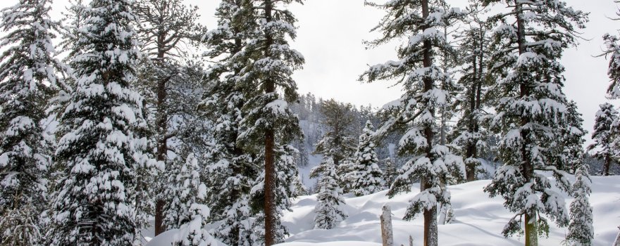
Snowpack:
Snowpack is monitored using two complementary methods: automatic snow sensor (or “pillow”) readings and manual snow course measurements. The snow sensors give us a daily snapshot of snow conditions while the manual snow course measurements provide a monthly verification of snow conditions in locations where snow has been measured in the same manner as far back as 100 years. A dry January resulted in a below average snowpack as of February 1. February snow course measurements show the statewide average at 74 percent of average. As of February 10, the statewide snowpack based on the automated snow sensor network is 60 percent of average to date and 43 percent of the April 1 average. The results of the February 2020 statewide snow surveys are as follows:
| Region | No. of Courses Measured | Average Snow Water Content (inches) | % Average April 1 | % Average February 1 |
| North Coast | 11 | 14.8 | 49 | 79 |
| Sacramento | 72 | 13.8 | 48 | 74 |
| San Joaquin Valley | 67 | 13.6 | 45 | 72 |
| Tulare Lake | 42 | 10.4 | 47 | 77 |
| North Lahontan | 11 | 9.4 | 42 | 67 |
| South Lahontan | 19 | 8.5 | 43 | 68 |
| Statewide Average (weighted) | 46 | 74 | ||
The automated snow sensor network shows similar results to those found in the manual snow course readings. The snowpack as of the morning of February 10, 2020 stands at the following (based on snow sensors):
| Region | Snow Water Content (inches) | % of Average (Apr 1) | % of Average (Feb 10) |
| Northern | 13.8 | 47 | 64 |
| Central | 12.4 | 42 | 58 |
| Southern | 9.8 | 38 | 56 |
| Statewide | 12.1 | 43 | 60 |
Since February 1, there is no change to the statewide snowpack snow water content; it remains at 12 inches.
Weather and Climate Outlooks:
According to CNRFC 6 day forecast, precipitation in southern California wraps up tonight and after that no precipitation in sight anywhere in the State for the whole week. A weak system forecasted to move towards northern California by the end of the week may bring in lighter amounts of precipitation over northern California down to the central Sierra. On average, approximately 0.2 inches of precipitation is expected to fall over Klamath and North Coast basins, and under 0.1 inch over northern California and central Sierra on Saturday.
Freezing elevations through Wednesday will be high all across the State ranging from 8,000 to 10,000 feet. From Thursday through Saturday, elevations will range from 6,000 to 8,000 feet except in Klamath where it will be around 5,000 feet. The NWS Climate Prediction Center (CPC) one‐month outlook for February 2020 issued on January 31, 2020, points to increased chances of above normal temperatures all across the State.
The same outlook suggests increased chances of below normal precipitation for the northern and central parts of the State, and equal chances of above or below normal precipitation for the southern part of the State. The CPC three‐month (February-March-April) outlook, issued on January 16, 2020, points to increased chances of above normal temperatures all across the State. The same outlook suggests increased chances of below normal precipitation all across the State. According to the latest El Niño/Southern Oscillation (ENSO) discussion issued by the Climate Prediction Center on February 10, 2020, ENSO-neutral conditions are present. Equatorial sea surface temperatures are near-to-above average across the Pacific Ocean. ENSO-neutral is favored through Northern Hemisphere spring 2020 (~60% chance), continuing through summer 2020 (~50% chance).
Next Update: A Bulletin 120 update for conditions as of February 11 will be available Thursday, February 13. The March 1, 2020 Bulletin 120 and Water Supply Index forecasts will be available on Monday, March 9, 2020. If you have any questions regarding this forecast, please contact a member of the Snow Surveys staff.
Important Links:
Full Natural Flow Data:
- Daily FNF: http://cdec.water.ca.gov/reportapp/javareports?name=FNF
- Monthly FNF: http://cdec.water.ca.gov/reportapp/javareports?name=FNFSUM
- Seasonal FNF: http://cdec.water.ca.gov/reportapp/javareports?name=FLOWOUT
Precipitation Data:
- Latest Northern Sierra 8-Station Precipitation Index: http://cdec.water.ca.gov/cgi-progs/products/TAB_ESI.pdf
- Latest San Joaquin 5-Station Precipitation Index: http://cdec.water.ca.gov/cgi-progs/products/TAB_FSI.pdf
- Latest Tulare Basin 6-Station Precipitation Index: http://cdec.water.ca.gov/cgi-progs/products/TAB_TSI.pdf
Snow Data:
- Latest Snow Sensor Report: http://cdec.water.ca.gov/reportapp/javareports?name=PAGE6
- Latest Statewide Summary of Snow Water Equivalents: http://cdec.water.ca.gov/reportapp/javareports?name=DLYSWEQ
Extended Regional Forecasts:
- California Nevada River Forecast Center 6 Day QPF and Snow Level Forecast: http://www.cnrfc.noaa.gov/awipsProducts/RNOHD6RSA.php
- Climate Prediction Center One-Month Outlook Forecasts: http://www.cpc.ncep.noaa.gov/products/predictions/30day/
- Climate Prediction Center Three-Month Outlook Forecasts: http://www.cpc.ncep.noaa.gov/products/predictions/long_range/seasonal.php?lead=1
- U.S. Seasonal Drought Outlook: http://www.cpc.ncep.noaa.gov/products/expert_assessment/sdo_summary.html
- Weather Forecast Office California Service Area-Products: http://www.cnrfc.noaa.gov/forecasts.php
- El Niño Southern Oscillation (ENSO) Conditions and Weekly Discussion (including La Niña): http://www.cpc.ncep.noaa.gov/products/analysis_monitoring/lanina/enso_evolution-status-fcsts-web.pdf
Bulletin 120: Historical forecast error plots can now be accessed at the link below. The plots compare actual and forecasted Bulletin 120 runoff projections for individual basins through WY 2018.
- Historical Forecast Error Plots: http://cdec.water.ca.gov/snow/bulletin120/B120_error_fcast_plots.html