
From the Department of Water Resources:
A Water Year 2018 Water Supply Index (WSI) forecast for conditions as of January 1, 2018 is posted at http://cdec.water.ca.gov/cgi-progs/iodir_ss/wsi .
The WSI forecast is based on the precipitation and runoff (full natural flow) through December 2017 and can be summarized as follows:
Sacramento River Unimpaired Runoff Water Year Forecast (50 percent exceedance)
15.9 (89 percent of average)
Sacramento Valley Index (SVI) (50 percent exceedance)
8.1 (Above Normal)
San Joaquin Valley Index (SJI) (75 percent exceedance)
2.3 (Dry)
The month of December was extraordinarily dry statewide with very little precipitation, minimal change in the mountain snowpack, and a large drop in runoff due to the dryness.
Runoff:
Unimpaired flows for the 2017-2018 water year have run at the following rates of average:
Region October-December Runoff (%) December Runoff (%) Sacramento Valley Index (4 rivers) 72 37 San Joaquin Valley Index (6 rivers) 89 40 Tulare Lake Basin (4 rivers) 78 48 Precipitation:
The regional monthly precipitation totals were 0.7 inches (7 percent of average) for the Northern Sierra 8-Station Index, 0.3 inches (4 percent of average) for the San Joaquin 5-Station Index, and 0.1 inches (2 percent of average) for the Tulare Basin 6-Station Index. Precipitation for the 2017-2018 water year accumulated at the following rates of average:
Region WY accumulated precipitation (%) through December 31, 2017 Sacramento River Valley 67 San Joaquin River Valley 45 Tulare Lake Basin 21 Statewide 47 Regional Precipitation Indices As of December 31, 2017 Northern Sierra 8-Station Index 67 (12.6 inches) San Joaquin 5-Station Index 37 (5.0 inches) Tulare Basin 6-Station Index 22 (2.0 inches) As mentioned, December was extraordinarily dry with statewide precipitation accumulation at just under 9 percent of average. Southern California has been exceptionally dry with just 1 percent of the total water year expected rainfall having been observed by the end of the calendar year along the South Coast region and zero percent in the South Lahontan and Colorado River regions. This dry environment exacerbated the record setting wildfire conditions during December in Southern California.
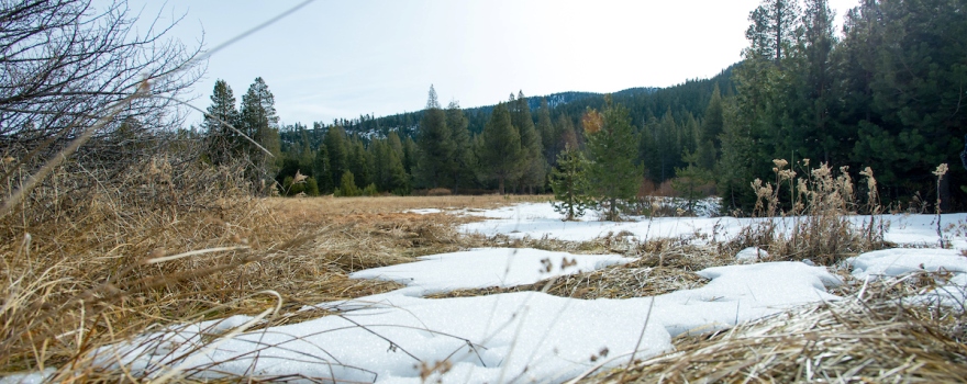
Snowpack:
The snowpack as of the morning of January 9, 2018 stands at the following (based on snow sensors):
Region Snow Water Equivalent (inches) % of Average (Apr 1) % of Average (Jan 9) Northern 2.3 8 18 Central 3.8 13 30 Southern 2.5 10 26 Statewide 3.0 11 26
Weather and Climate Outlooks:
The 6-day weather forecast predicts 0.5-1.0 inches of precipitation accumulation over Sierra Nevada with the majority of it falling today. Areas in Southern California are expected to receive 1.5 inches of precipitation today with some areas expected to receive up to 4.0 inches locally. The Thomas Fire burn area is expected to receive 2.5 inches of precipitation today. Freezing levels are lowest today near 7,000-8,000 feet and are expected to rise up to 12,000 feet by the end of the six day period.
The NWS Climate Prediction Center (CPC) one‐month outlook for January, made December 31, indicates increased chances of above normal temperatures for the whole state and increased chances of below normal precipitation for the northern half of California.
The CPC three‐month (January‐February-March) outlook, posted December 21, indicates increased chances of above normal temperatures for the lower ¾ of the state. For the areas to the north of this region including the Feather, Sacramento, and Trinity watersheds, the outlook calls for equal chances of above or below normal temperatures. The same outlooks calls for increased chances of below normal precipitation except for a band along the Oregon border where equal chances of above or below normal precipitation is forecast.
According to the latest El Niño/Southern Oscillation (ENSO) discussion issued by the Climate Prediction Center on January 8, 2018, La Niña conditions are present. Equatorial sea surface temperatures (SST) are below average across the central and eastern Pacific Ocean. La Niña is likely (exceeding ~80%) through winter 2017-18, with a transition to ENSO-neutral most likely during the mid-to-late spring.
Next Update:
The next WSI forecast for conditions as of February 1, 2018 will be available on February 8. The first Bulletin 120 of the 2018 water year will also be issued at that time. If you have any questions regarding this forecast, please contact a member of the Snow Surveys staff.
Important Links:
Full Natural Flow Data:
- Daily FNF: http://cdec.water.ca.gov/cgi-progs/snowsurvey_ro/FNF
- Monthly FNF: http://cdec.water.ca.gov/cgi-progs/snowsurvey_ro/FNFSUM
- Seasonal FNF: http://cdec.water.ca.gov/cgi-progs/snowsurvey_ro/FLOWOUT
Precipitation Data:
- Latest Northern Sierra 8-Station Precipitation Index: http://cdec.water.ca.gov/cgi-progs/queryDaily?s=8SI&d=today
- Latest San Joaquin 5-Station Precipitation Index: http://cdec.water.ca.gov/cgi-progs/queryDaily?s=5SI&d=today
- Latest Tulare Lake Basin 6-Station Precipitation Index: http://cdec.water.ca.gov/cgi-progs/queryDaily?s=6si&d=today
Snow Data:
- Latest Snow Sensor Report: http://cdec.water.ca.gov/cgi-progs/snow/PAGE6
- Latest Statewide Summary of Snow Water Equivalents: http://cdec.water.ca.gov/cgi-progs/snow/DLYSWEQ
Extended Regional Forecasts:
- California Nevada River Forecast Center 6 Day QPF and Snow Level Forecast: http://www.cnrfc.noaa.gov/awipsProducts/RNOHD6RSA.php
- Climate Prediction Center One-Month Outlook Forecasts: http://www.cpc.noaa.gov/products/predictions/30day/
- Climate Prediction Center Three-Month Outlook Forecasts: http://www.cpc.noaa.gov/products/predictions/long_range/seasonal.php?lead=1
- U.S. Seasonal Drought Outlook: http://www.cpc.ncep.noaa.gov/products/expert_assessment/sdo_summary.html
- Weather Forecast Office California Service Area-Products: http://www.cnrfc.noaa.gov/forecasts.php
- El Niño Southern Oscillation (ENSO) Conditions and Weekly Discussion (including La Niña): http://www.cpc.ncep.noaa.gov/products/analysis_monitoring/lanina/enso_evolution-status-fcsts-web.pdf
 Sign up for daily email service and you’ll never miss a post!
Sign up for daily emails and get all the Notebook’s aggregated and original water news content delivered to your email box by 9AM. Breaking news alerts, too. Sign me up!
