 This post was written by guest contributor Roberta Long.
Heaven-sent rainfall greeted guests on Wednesday, Oct. 15, when Mountain Counties Water Resources Association presented “Innovative Water Technologies for California” at the Lake Natoma Inn in Folsom. After three dry years, nearby Folsom Lake was at 65 percent of its average water level and 35 percent of capacity. Looking east, the Sierra Nevada granite cap was completely barren of snow. The few hours of rain would not make a difference in the region’s water supply, but it was greeted with smiling faces.
The program was the brainchild of Mountain Counties’ associate member Gary Luiz, who is the California representative for Parjana. A growing demand for water in California combined with a reduced supply requires new approaches. Parjana has developed an energy-passive groundwater recharge product. Luiz believes that there are many companies and consultants who have developed new ways of managing water that are not yet well known.
Parjana and Parjana Distribution, along with Floating Islands West, co-sponsored the event. With contributions from nine participants, it was offered free to members of the water industry. The participants were: West Consultants, Inc., NLine Energy, Cardno Entrix, SAGE Engineers, URS Consulting, Inc., D&A Civil Engineering, CONDOR Earth Technologies, Inc. and Churchwell White.
Introduction
 Mountain Counties Executive Director John Kingsbury introduced the program, saying, “This is about California getting better together. We are one state, one water system, and we need to seriously look at these technologies and case studies and implement them wherever feasible in the state.” He emphasized that the technologies on the program are a sampling of what is available now.
With reference to the co-equal goals for the Sacramento-San Joaquin Delta of improving water reliability and providing ecosystem restoration and protection, he said all Californians should commit to achieving them not only in the Delta, but also in the mountains, on the coast and in the desert. By taking a comprehensive approach, “there are no losers in California,” he said.
Kingsbury pointed out that each of the innovative technology presentations address one or more goals of the California Water Action Plan (CAWP), also called the Governor’s Water Plan. Gov. Jerry Brown, in his 2014 State of the State Speech, emphasized, “We need regulators to rebalance water rules and enable voluntary transfers and we must prepare for forest fires.”
He convened an Interagency Drought Task Force and declared a state of emergency. The task force consisted of the Secretary of Natural Resources, the Secretary of the California Department of Food and Agriculture, and the Secretary of the California Environmental Protection Agency. The Governor introduced their statewide water management plan in his speech.
The plan calls for collaboration in 10 action areas:
1. Make conservation a California way of life;
2. Invest in integrated water management and increased regional self-reliance;
3. Achieve the co-equal goals for the Delta;
4. Protect and restore important ecosystems;
5. Manage and prepare for dry periods;
6. Expand water storage capacity and improve groundwater management;
7. Provide safe drinking water and secure wastewater systems to all communities;
8. Increase flood protection;
9. Improve operational and regulatory efficiency;
10. Identify sustainable and integrated financing opportunities.
Re-imagining groundwater management
 Joe Kramer, Partner, Parjana
Water cannot soak into ground that is compacted either because of its composition or because the groundwater basin has been overdrafted to the point that the ground has subsided, or sunk. The result is either undesirable runoff or standing water.
Some people think of groundwater as an underground lake. Layers of sand, gravel or silt act more like a big wet sponge. Water saturates the tiny spaces between the materials. Groundwater also accumulates in fractures between big rocks. Groundwater contributes to river flows as well as providing water from wells and pumping. The benefits of this hidden resource are at risk during extended drought periods. During heavy rains, compacted ground cannot absorb the volume of water.
Parjana’s patented Energy Passive Groundwater Parjanas (EGRP) has recently become commercially available on the West Coast for large-scale projects. The EGRP system works to eliminate standing water through impermeable soil types. Tubes from 8 to 40 feet in length are inserted into the ground with a drilling rig. Rather than forcing water into the ground, the system creates a vacuum with negative pressure, the same principle as a vacuum cleaner. It uses the natural forces of suction, gravity and hydrostatic pressure to move the water horizontally through micro-layers in the soil. Kramer said the system works best in clay because clay structure is horizontal.
Kramer said EGRP’s surface benefits are that it infiltrates water, reduces runoff water, stabilizes ground, and waterproofs foundations. The underground benefits are: reduction of hydrostatic pressure, improvement in moisture content, recharge of groundwater, and rebalance of waterflow. “It’s the next generation of water management,” he said.
- View power point here: PARJANA – Joe Kramer -Re imagining groundwater management
Local conjunctive water management and water saving opportunities
 Joe Domenichelli, P.E., President, Domenichelli & Associates
Domenichelli & Associates have been located in El Dorado Hills for 12 years. Domenichelli said that one of the emerging trends in California is developing water savings projects. He focused on local projects that address the California Water Action Plan goal of improving regional self-reliance.
Rancho Murieta Community Services District installed a conjunctive use system within the district to increase its water supply during drought. With two new wells and new pipelines to a central treatment location the district increased capacity by 600 gallons per minute. The project can use temporary portable treatment as necessary.
The Antelope Pumpback Project is an example of conjunctive water use between agencies. Sacramento Suburban Water District will use surface water from San Juan Water District when possible. San Juan will receive groundwater from Sacramento Suburban during drought periods. The exchange uses existing infrastructure, plus a cooperative transmission pipeline., a pressure reducing station, and a pumpback facility. The station allows for potential pumpback from San Juan Water District to Placer County Water District.
Domenichelli cited other water savings projects, such as El Dorado Irrigation District’s Main Ditch Improvements and ditch lining and piping projects in the Mountain Counties. He said these projects address the goal of improving regional self-reliance through water supply and use efficiencies.
He identified typical project challenges and solutions in the areas of infrastructure needs and cost requirements, interagency agreements, groundwater quality and supply reliability, and environmental processes and permits.
- View power point here: Domenichelli & Associates – Joe Domenichelli – Local Conjunctive Water Management and Water Saving Opportunities
Hydropower generation opportunities
 Matthew Swindle, Founder and CEO, NLine Energy, Inc.
NLine is another company headquartered in El Dorado Hills. It specializes in water to energy recovery systems. A Class A General Engineering contractor, NLine is an Association of County Water Agencies Approved Preferred Provider.
Swindle concentrated his presentation on small hydroelectric energy recovery technologies.
We are now in the fourth hydropower renaissance, he said. The first was at Niagara Falls in the 1800s. Then came the Hoover Dam in the 1930s, Folsom Dam in the 1960s, and finally, the Federal Powers Act that authorized smaller hydropower facilities.
Newer hydropower technologies are smaller, modular and use off-the-shelf components. They use intelligent design (self-reporting), have less civil costs, and are cost-effective.
The Department of Energy defines large hydropower as facilities that have a capacity of more than 30 MW. Small hydropower plants have a capacity of 100 kW to 30 MW. Micro hydropower facilities have a capacity of up to 100 kW, enough for a home, farm, ranch or village. Swindler said that now even the micro-hydro power plants are financially viable.
 Small hydropower facilities operate with low-flow turbines and use the velocity of river currents, streams or tidal action rather than head pressure from dams or waterfalls.
Swindler showed the different turbines that work well for small hydropower–Kaplan, hydrodynamic screw (Archimedes), and hydrokinetic. He also illustrated the use of pumps as turbines. Pumps-in-reverse are highly efficient and cost-effective. Engines and power pipelines designed to operate in small hydro systems are available.
He said small hydropower facilities are environmentally benign. He offered a list of considerations for determining whether such a system is appropriate and if it qualifies for state and federal exemptions and credits.
- View power point here: NLINE Energy Inc – Matt Swindle – Small HYdrolectric Energy Recovery Technologies
Water banking – There is a market for it!
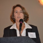 Barbara A. Brenner, Esq., Churchwell White, LLP
Sacramento water law attorney said all water districts in the state need additional dry year supplies. She directed her remarks to the Aquifer Storage and Recovery (ASR) programs, which she said could benefit all districts. Aquifers are the bodies of rock and sediment underground through which water passes.
ASR programs use conjunctive management. They coordinate the planned use and management of surface water and groundwater. Brenner said that in the past water resource engineers could rely on the timing and place of water supplies to remain relatively constant. With the projections for climate change, those assumptions no longer hold. The extent and timing of streamflows from snowmelt are expected to be more variable. The objective of ASRs is to maximize the availability and reliability of water supplies, addressing several of the California Water Action Plan goals. She mentioned the Kern Water Bank as an example, despite the legal challenges.
Brenner said the benefits of conjunctive water management pertain whether or not there is an hydraulic connection. In addition to increasing the reliability and amount of water supply, she cited further benefits: prevention of groundwater depletion by maintaining baseflow to streams; flood management; environmental water use; and water quality improvement.
She used as an example the South Westside Basin Groundwater Management Plan, which was issued in 2012 by five partners. The project will include installation of up to 16 new recovery well facilities in northern San Mateo County. Without this project, the South Westside Basin would be drawing water from Hetch Hetchy.
There are other ASRs in the Bay area, in Santa Clara Valley, Alameda County and Livermore, Pleasanton and Dublin. She also mentioned new regional programs such as the Sacramento Groundwater Authority.
Brenner outlined the considerations to be taken into account when developing an ASR. She said that better use of technology would have helped the program get started. Management and control are big issues.
- View power point here: Churchwell White LLC – Barbara Brenner – Water Banking – There is a market for it
A fresh look at water user-environmental frictions
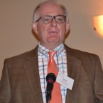 David Curtis, Ph.D, Vice President, WEST Consultants
Curtis served as president of the National Hydrologic Warning Council from 2011-2013. He manages the Folsom office of WEST Consultants (Water Environmental Sedimentation Technology).
He got right to the point, saying, “Climates change. That’s what climates do. California’s water climate can change rapidly–very rapidly.”
Curtis said the data is limited to weather records that use a relatively short time span. The latest forecast by the National Weather Service uses a 30-year average, from 1980 to 2010. Observational data is mostly 50 years. Sacramento’s weather records go back to 1850. Precipitation measured 5 inches to 35 inches annually. There were no normal years of precipitation. By averaging the extremes, average rainfall each year was around 18 inches. But this information was not useful for predicting what to expect in the future. By reconfiguring the data, Curtis created a 30-year trailing average from 1850 to 2014.
By his analysis, the climate in the Sacramento region is moving from high to low in 30 to 40 year increments. He said that during the 1930s the increase in precipitation was masked by the population increase. In 1930, California had around 6 million residents. In 2014, the estimated population of California is 39,309,017.
 Curtis found a correlation in the pattern of long-term precipitation and the Sacramento River streamflow, which would include snowmelt, from 1880 to 2006.
From 2000 to 2014, the region has had four years of above-normal precipitation and 10 years below. His said the region is a decade and a-half into a dry period. By 2050, he projects the region may be in a wet cycle.
Both the National Environmental Protection Act and the California Environmental Quality Act require long-term climate projections.
Curtis said the extreme variability and rapid transitions of weather in the region affects infrastructure planning to prepare for both floods and drought.
- View power point here: WEST Consultants – David Curtis – A Fresh Look at Water User-Environmental Frictions
Controlling sediment in mountain recreation areas
 Paul Wisheropp, P.E., Cardno ENTRIX
Wisheropp is a senior consultant at the Sacramento office of Cardno ENTRIX, an environmental and natural resource management consultancy. Cardno ENTRIX is a subsidiary of Cardno, a global provider of physical and social infrastructure services. In 2012 Wisheropp and two colleagues were named winners of the Most Distinguished Technical Paper award for their paper on the Kings Beach Watershed Improvement Project.
Camp Sacramento is a family camp operated by the City of Sacramento on 14 acres of land at 6,500 feet elevation leased from the Eldorado National Forest. It is located on the South Fork of the American River 15 miles from South Lake Tahoe. The camp started in 1920. It has 61 rustic cabins, a dining hall, lodge, store, nurse’s office, and outdoor sports facilities. Around 2,500 Sacramentans visit the camp from June through September each year.
After years of use, erosion and soil loss became severe. Particular problem areas were on the hill slopes, the entry road and camp roads, highway shoulder, camp visitor parking, volunteer trails and a heavy use area.
Funding for the project came from the Sierra Nevada Conservancy and a U.S. Forest Service grant. The interested parties, besides Sacramento, the El Dorado, and the conservancy, were Caltrans, the El Dorado County Resource Conservation District, and the Friends of Camp Sacramento.
 Requirements included balancing new facilities with recreation use; blending improvements with existing aesthetic characteristics; low maintenance; ability to withstand winter forces, use of native materials, and ADA compliance. The erosion control master plan calls for a paved roadway with a rolled curb, limited underground storm drains, multi-use detention basins, defined parking, rock slope protection, revegetation, and dripline trenches. It includes parking for Lover’s Leap Trailhead.
In the course of construction, field adjustments had to be made. Steps were added from the highway to replace eroded trails visitors made that carried sediment to the river.
The final steps were to review the site and check to see if the improvements were working, and to provide temporary measures until the entire project could be completed.
- View power point here: Cardno ENTRIX – Paul Wisheropp – Erosion Control in Mountain Recreation Areas
Geology of groundwater and aquifer management
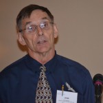 John Kramer, Ph.D., Principal Hydrogeologist, CONDOR Earth Technologies, Inc
Condor’s five offices are located in the Sacramento and San Joaquin valleys and the Sierra Nevada foothills. Kramer works in the Roseville office, where services include groundwater, wastewater, storm water and surface water.
Kramer quoted Gov. Jerry Brown as he introduced the California Water Action Plan in January 2014: “…water recycling, expanded storage and serious groundwater management [emphasis added] must all be part of the mix. It is a tall order. But it is what we must do to get through this drought and prepare for the next.”
Groundwater provides 40-60 percent of California’s water supply. The Plan states: “Inconsistent and inadequate tools, resources and authorities make managing groundwater difficult in California and impede our ability to address problems such as overdraft, seawater intrusion, land subsidence, and water quality degradation.”
Kramer said many water managers are not fully informed about groundwater and stressed the need for proper management. He cited the example of Las Posas Basin Aquifer in Ventura County. What the decision makers found out was that their project does not work for a drought.” It was an expensive lesson. The cost was estimated at $47 million in 1995. The final bill tripled to $150 million.
The Sustainable Groundwater Management Act (AB 1739, SB 1168, SB 1319) was passed in August 2014. It states: “Decision makers in local government and water districts will need to understand groundwater management issues.”
 Kramer said that natural recharge is slow. The Eastern San Joaquin Groundwater Sub-basin formed 2,200 to 13,400 years before the present. He called the flow of underground water “tortuous.” The speed of water particles traveling in a linear fashion (transmissivity) in a silty-sand aquifer ranges from less than one to less then 200 feet per year because they have to navigate around and through grains of sand, soil and stone.
Kramer said there is some confusion about whether earth is rising or falling due to groundwater loss in California. He made the comparison. Subsidence rates caused by silt and clay compaction have been as high as more than one foot a year. Uplift occurring when the weight of water is gone, is much smaller, little more than one inch a year. Both are occurring, but there is more fall than rise.
Kramer said that hydrogeologic basics are intuitive, like water runs downhill. Aquifers are managed by controlling gradients with artificial recharge wells. A steep gradient increases flow; a declining gradient reduces flow. Geology is what controls an aquifer geometry, storage and transmissivity. Researching, testing, designing, modeling, monitoring and managing an aquifer calls for professional expertise.
- View power point here: CONDOR – John Kramer – Geology of Ground Water and Aquifer Management
Increasing water yield with regional water storage possibilities
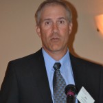 Jeff Meyer, P.E., Director, Water Resources Management, ECORP Consulting, Inc.
ECORP has an array of specialists who provide environmental services for a variety of project types. The company has four offices in California. Meyer works in the Rocklin office.
Meyer said 2014 is the 9th driest year on record for the American River. The years 1976-77 were the two driest sequential years.
The catalysts for new storage are: growing consumptive demand, climate change, and State Water Resources Control Board (SWRCB) curtailment notices. Curtailments have been issued for junior (post-1914) water rights. Senior (pre-1914) water rights will be curtailed if necessary. Future diversions will also be affected by hydrologic limitations, or lack of water. New storage is essential just to meet existing demand in dry years.
Meyer mentioned two incentives for creating new water storage facilities. New water storage is consistent with eight of the 10 actions in the California Water Action Plan. Proposition 1 offers $2.7 billion for water storage projects, dams and reservoirs.
One project Meyer commended is installation of radial gates at Foresthill Public Utility District’s Sugar Pine Reservoir. The district purchased the facilities, located in the Tahoe National Forest, from the U.S. Bureau of Reclamation in 2003. The Bureau built the dam in 1982. It has a dual spillway, with trunnion blocks in place, but the two radial gates were never installed. The reservoir capacity is 6,922 acre-feet. Completing the dam with the radial gates will increase the reservoir capacity to around 10,000 acre-feet. The project would comply with the CAWP by strengthening the district’s self-reliance and supporting fire suppression.
 Another project is Nevada Irrigation District’s Parker Reservoir. This facility would provide 110,000 acre-feet of new storage, plus hydropower and recreational facilities.
ECORP used LIDAR (Light-imaging detection and ranging), a remote sensing technology using aircraft, to determine the site for the dam and reservoir on the Bear River. LIDAR provides more information than can be obtained by aerial photographs or accessed by ground surveys. It is especially useful on large projects.
Parker Dam and Reservoir has been part of NID’s water portfolio in 1926. Facing the prospect of diminished water supply from snowmelt in the future, NID found it necessary to develop a storage facility at a lower elevation to ensure water supply reliability for its customers in Nevada and Placer counties.
- View power point here: ECORP Consulting – Jeff Meyer – Increasing water yield with regional water storage possibilities
Seismic dam safety and risk assessment
 Marc Ryan, P.E., G.E., Principal Engineer, SAGE Engineers
SAGE Engineers is a geotechnical and engineering firm headquartered in Roseville. Ryan specializes in risk-based earthquake engineering and dam safety evaluations.
There are only two new large dams that are being planned, Sites Reservoir, off the Sacramento River, and Temperance Flat, on the San Joaquin River.
Ryan talked about the advantage of improving small-scale storage facilities. They are already paid for. There are fewer environmental and permitting obstacles. Real estate acquisition is minimal. There is existing knowledge of operations and maintenance. There is an opportunity to enhance recreational activities. To do so, a comprehensive Dam Safety Program must be developed and implemented.
The situation with small dams is ripe for renewal. Most small dams are at the end of their 50-year design cycle. Where regular maintenance has been deferred, more serious problems arise.
Fifty-six dams are currently under restrictions due to dam safety issues. As a result, California has lost 470,000 acre-feet of storage.
Comprehensive dam safety programs include construction history, performance history, instrumentation, reporting procedures, instrumentation thresholds, inundation mapping, energy action plans, institutional knowledge and relationships with regulators.
Risk analyses are both quantitative and qualitative. Ryan presented a cross-analysis of the two components of risk, where the probability of dam failures are scaled on one axis, and the consequences are scaled on the other. Probability is measured as very high, high, moderate and low. Consequences are loss of life, economic loss (operations, irrigation, generation), environmental loss, loss to infrastructure, and loss of public trust.
 Potential dam failures might be caused by overtopping and erosion leading to a breach. There would be some time to respond. Another source would be an earthquake causing liquefaction, where the dam material becomes liquified. There might be some time to respond. The third scenario would be a plane crash, destroying the dam. In that case, there would be no time.
To reduce the probability of failure, dams can be retrofitted. To reduce the consequences of failure, evacuation plans can be improved, instrumentation can be improved, and downstream floodwalls and levees can be improved or constructed.
Risk Informed Decision Making is the overall approach to dam safety. It includes probabilistic seismic hazard analysis, probability of maximum flood, probability of failure, consequences of failure, and risk reduction measures. This approach applies to retrofitting existing dams and siting new dams. Ryan said this approach could bring water storage back to communities.
He concluded by saying that policy makers need to understand risk and encourage regulators to adopt risk. Technical staff need to communicate the concepts of risk to non-technical policy makers.
- View power point here: SAGE – Marc Ryan – Seismic Dam Safety – Risk Assessment
A watershed approach to fish passage feasibility
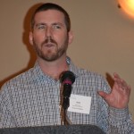 Jonathan Stead, Senior Project Ecologist, URS Corporation
URS Corporation provides engineering, environmental, construction and technical services to public agencies and private sector companies worldwide. Stead works in the Oakland office.
He explained how a watershed approach to identifying fish passage feasibility resolved the issue at Calaveras Dam, allowing a replacement dam project to proceed.
The 210-foot high Calaveras Dam was built in 1925. It is located at 756 feet elevation about a mile upstream from the confluence of the Calaveras and Alameda creeks. Calaveras Reservoir receives waters from Calaveras Creek and Arroyo Hondo, and from upper Alameda Creek via a diversion tunnel. The dam blocked the Coho salmon and steelhead trout migrations in Alameda Creek.
Since 2001 storage has been restricted to 30 percent of its design capacity of 96,850 acre-feet because it is near two earthquake faults and does not meet current seismic standards. Studies showed that if the dam collapsed during a large earthquake on the nearby Calaveras Fault, it would send a 30-foot high wall of water west to Fremont and toward Interstate 880. Such an event could kill thousands of people.
The Calaveras Dam Restoration Project is part of a 15-year, $4.6 billion upgrade of the Hetch Hetchy water system of five reservoirs. However, since 1997,when the Central Coast steelhead were listed as threatened under the Endangered Species Act, the 45-mile Alameda Creek has been the focus of intensive restoration.
The new 220-foot high Calaveras Dam that is designed to meet current earthquake standards ran into the obstacle of providing fish passage, which had not been a requirement of the original dam design. Stead and three URS colleagues conducted feasibility studies for providing fish passage at Calaveras Dam or an alternative site.
 The Calaveras Dam site proved formidable for fish passage. A fish ladder would need to be 290 vertical feet. The reservoir forebay fluctuated 70 feet. Fish would not attempt passage. Trap and haul was the only feasible option at Calaveras.
Stead and team evaluated in-stream features that would be potential barriers to fish passage.
Upstream 1.8 miles is a 17-foot waterfall on Calaveras Creek. Downstream 200 feet is a 12-foot waterfall on Arroyo Hondo, site of an ancient and active landslide. The benefit to a limited number of fish at a relatively high cost led themq to investigate alternative solutions.
Viewing the Arroyo Hondo watershed as a whole, they identified suitable steelhead habitat upstream from the 31-foot Alameda Creek Diversion Dam and tunnel. A fish ladder is technologically feasible at that site, and screens can be placed on pipes. They prepared a feasibility cost estimate, including capital investment, annual costs, and the cost of replacing water not diverted. They found that the effort to establish steelhead above the diversion dam would have a reasonable probability of success, both biologically and economically. San Francisco Public Utilities District received approval for the new dam based on the URS analyses.
Stead said the URS studies using a watershed approach provided a rational, technical foundation for decisions. They were able to set aside costly recommendations to modify the dam replacement project, and create a basis for feasible permit terms and conditions. Potential permit delays were reduced. The results were incorporated into the final environmental review document and permit applications.
- View power point here: URS – Jon Stead – A Watershed Approach to Fish Passage Feasibility
Conclusion
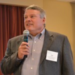 By the time the program ended, the sun returned to dominate the weather pattern in northern California. Mountain Counties President Don Stump thanked the presenters and the audience. He said that based on the interest shown, and the quality of the presentations, he anticipates this will be an annual event.
Photo credit: Photography provided by the Mountain Counties Water Resources Association.

