From the California Weather Blog:
“The weather in California has been relatively uneventful over the past few weeks. Periodic thunderstorm activity has continued to affect mainly inland desert and mountain areas, mostly in the southern part of the state.
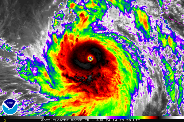
Hurricane Marie–once a formidable category five storm in the eastern Pacific ocean–brought pretty clouds (but also damaging surf conditions) to much of the state this past week. While there had been preliminary indications in forecast models that a substantial amount of Marie’s remnant moisture and perhaps even the storm’s former center of circulation might be steered toward California, perhaps bringing some rare summer rains, that solution has (obviously and unfortunately) not come to pass. Near-shore sea surface temperatures remain extremely warm, with buoys off the coast of the San Francisco Bay Area repeatedly registering all-time record high ocean temperatures.
These very warm temperatures have resulted primarily from greatly reduced cool water upwelling near the California Current, which itself stems from suppressed northwesterly winds caused by persistent atmospheric ridging. It’s also possible that there has been some contribution by so-called “coastally-trapped” Kelvin waves, triggered by the massive equatorial Kelvin wave that occurred in the tropical Pacific earlier this year. … ”
Continue reading for more on the drought, the fire season, an update on El Nino, and the Californa Weather Blog’s thoughts for the coming season here: California’s drought very unlikely to improve in short term; thoughts about the upcoming winter rainy season


