From the California Weather Blog:
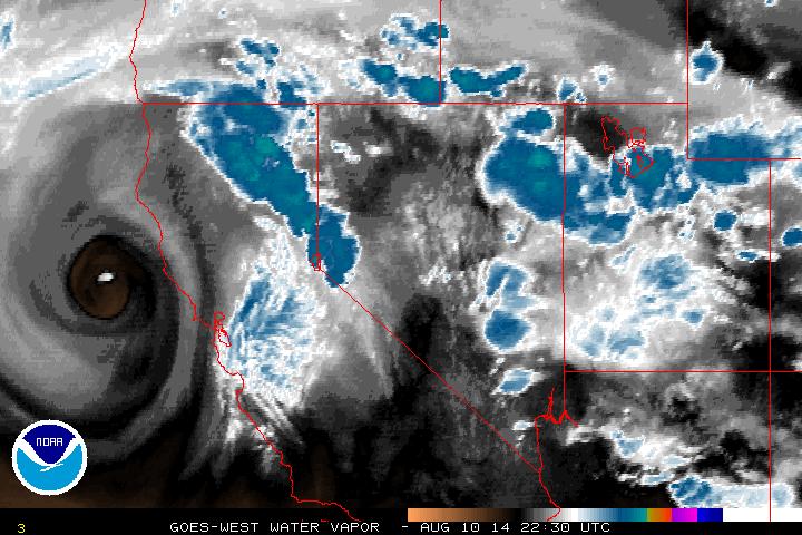
California’s very active summer pattern (see below) is set to continue over the next few days. As of Sunday afternoon, a well-defined cutoff low had set up shop about 150 miles northwest of San Francisco.
This low–which is rather deep for the late-summer months–has actually begun to retrograde (move back westward) while sending some spokes of energy northward around the east side of its circulation center. This low is quite moisture-starved, with convective activity thus far mostly confined to the west slopes of the Sierra Nevada and near Mt. Shasta. However, a few lightning strikes have recently been detected near the low center ~100 miles NW of San Francisco over the open ocean, which suggests that significant elevated instability is starting to overcome the very dry environment near the low center.
In many ways, the current setup closely matches the classic scenario for widespread late summer/early fall lightning events across Northern California. …
Plus … is the Ridiculously Resilient Ridge still hanging on out there, poised to make a comeback? Find out from the California Weather Blog here: Major lightning outbreak/fire weather event likely in California, part of very active summer monsoon in 2014


